


Dispatch 10: The 'Cruiseship' JCR
15th August 2012
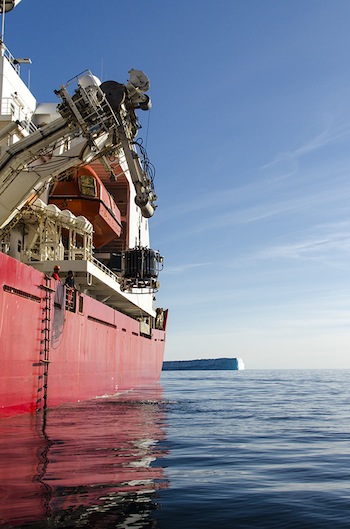 |
Three CTD watches, consisting of smart graduate and post-doctoral students, JCR’s crew, and the ship herself have been laboring around the clock for the last ten days, 190 casts down, as many more to come. Bob is noted, some might say notorious, for the tight resolution of his CTD casts (to measure temperature, salinity, and current velocity), sometimes only two miles apart. The last cast in the most recent line was to take us close aboard the Greenland coast within 30 miles of Scoresby Sund, the largest fjord in the world.
A rumor began to ricochet around the ship, shipboard rumor being surely the fastest form of non-technological communication: Having perceived that the weary crew and science staff would benefit, along with the science itself, from a brief break, Bob was going to give us a tour of Scoresby Sund. As chief scientist, he has essentially chartered JCR, paying for the cruise with a grant from the National Science Foundation. He doesn’t give orders; only the captain does that, but the ship takes him where he needs to go, if possible. The rumor was soon affirmed as fact. Trouble was, we’d been working in blind fog seemingly forever.
"A rumor began to ricochet around the ship, shipboard rumor being surely the fastest form of non-technological communication" |
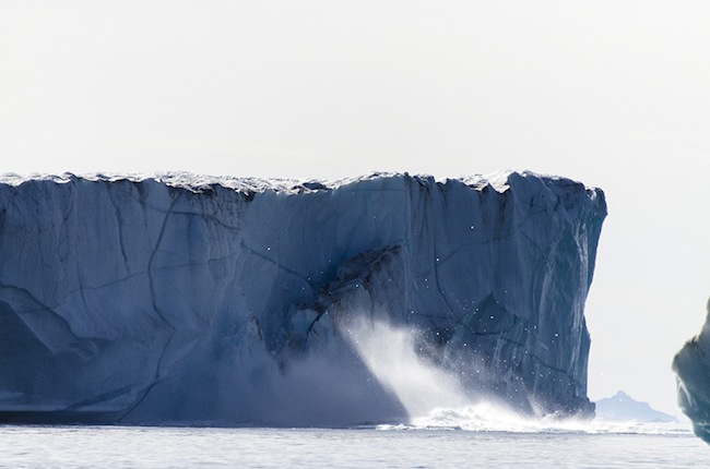
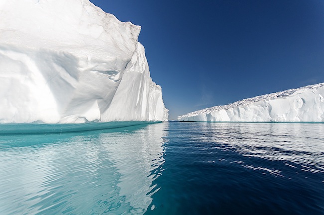
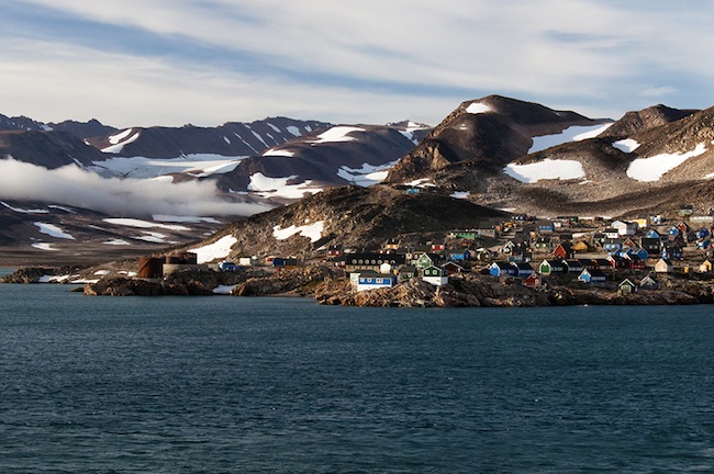
We powered out of a fog bank—and there it was, the northern point of the fjord, in the clear. Crew in their civvies along with the science staff gathered as tourists on the bow, on the bridge, and the “monkey Island” atop the bridge, some of us giggling like children at the sheer magnificence. As we rounded the point, the settlement of Ittoqqortoormiit, population 300, hove into sight, houses of red, blue, yellow, burnt umber, butterscotch, and purple barnacled to the rocks. Still called Scoresbysund on our nav chart, the town, one of the most remote in all Greenland, was established in 1925 by a band of eighty Inuit settlers from Tasiilaq, who found good hunting in the region for walruses, narwhals, bears, and seals. Ittoqqortoormiit, when we passed, was fronted by three spectacular bergs, one the size of a toppled Midtown Manhattan office tower with brash ice drifting down current glinting in the soft light. On the far side of the fjord, layers of snow-clad, black-rock mountains sprawled in the blue distance twenty-nine miles away, but through the crystalline air, looked as if they were three miles off the beam (without trees or building or anything else to gage scale, it’s impossible to judge distance).
 |
The painted town disappeared behind Cape Hope when the Captain turned his ship around a huge tabular berg into Hurry Inlet, a fjord within the big fjord, stretching 25 miles due north. On our starboard hand: a low-lying, almost meadow-like landscape strewn with boulders of indeterminable size backed by pyramid mountains with tongues of glaciers weaving around their flanks. Away to port: serrated mountains with their layered bands of sand- and limestone, basalt and columns of greenstone dropped vertically into the sea. Standing on her bow, we talked and laughed and delightedly pointed out to each other this feature and that, passing a pair of binoculars back and forth, and, lacking hard knowledge, we speculated on geological cause and effect. As if all we’d seen were still insufficient, at 2300, the sunset treated us to an extravagance of yellows and oranges backlighting the saw-toothed mountains while high wisps of icy-white cirrus seemed to emanate from the sun glow. Ben, Sam and I ended that wonderful evening with a sauna while we listened to Miles Davis, Kind of Blue. No kidding. And then there was still the morning after.
 |
It was a beach day, warm, cloudless, the sea dance-floor flat. In fact, there was a beach, rare indeed in these parts, if with snow instead of sand, at the bottom of a bowl carved in the mountainside by a vanished glacier. Chief mate Robert was at the helm, exuding his usual high professionalism, conning her dead slow over un-sounded bottom close aboard, really close, to a place called Kap Tattershall, aiming at a CTD position amid several sparkling bergs. “Bottom’s coming up now, seventy-nine meters,” he said, stepping back to the helm from the echo sounder. “There’s a moraine here….Sorry this is taking so long, Bob.” Was he kidding? Bob and I watched as he stopped the ship in 50 meters, “three cables” (0.3 nautical miles) from the beach. The on-duty watch deployed the CTD.